Point cloud delivery for surveyors
Your client clicks a link.
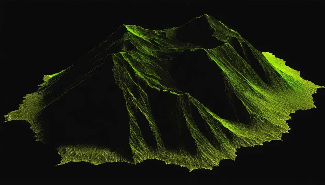
This is what they see.
One link opens the full interactive viewer in any browser. No installs, no accounts on their end. The live demo below streams a real ten million point scan.
plans from $29 / viewing is always free
$29
commercial entry
∞
free viewers
every feature
on every plan
links
never expire
How it works
Three steps. Only one of them is yours.
01
Upload
Drag in a LAS or LAZ from the browser. Any size. It goes straight to storage, not through our servers.
02
We optimize
Your cloud is converted to a streaming format. Viewers only download what is on screen, so big files open fast.
03
Send the link
Password optional. Revoke anytime. The person on the other end needs nothing but a browser.
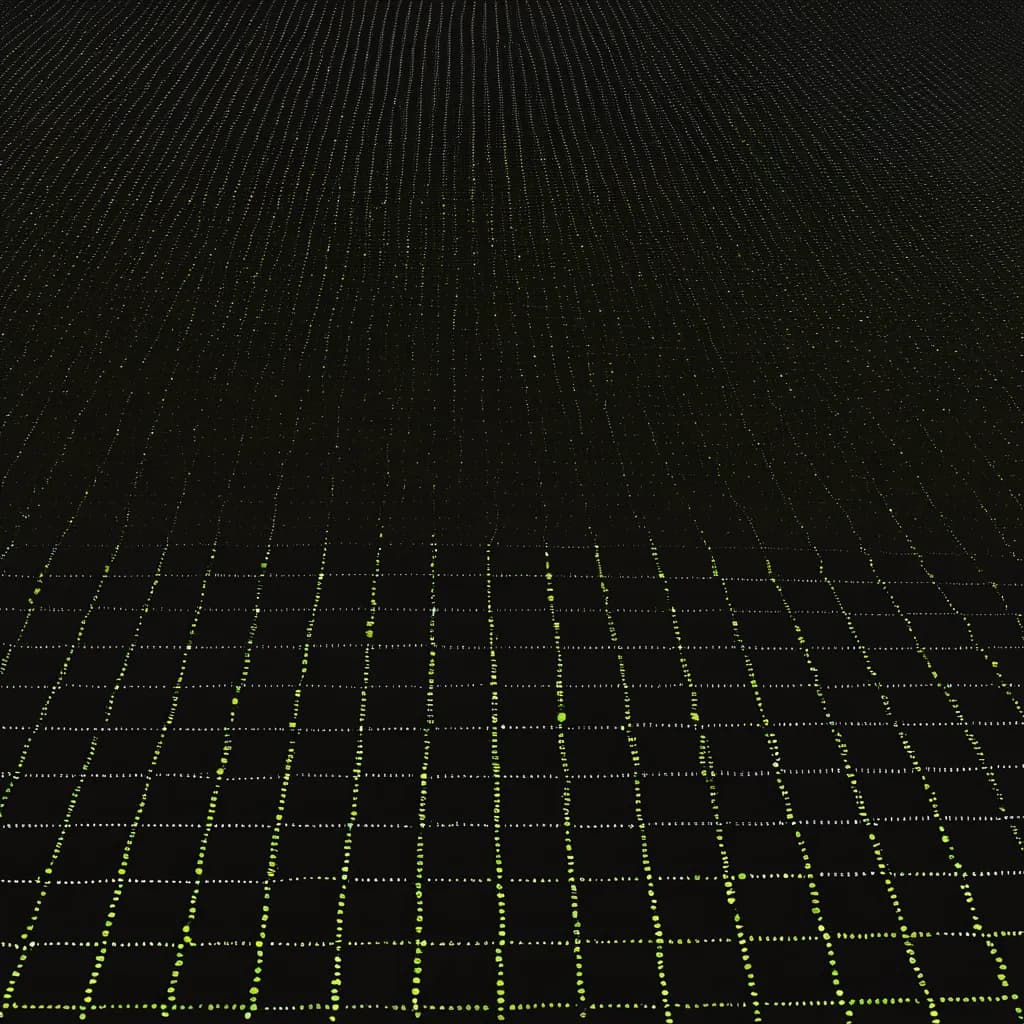
In the viewer
Tools your clients can actually use
- Distance with horizontal and elevation deltas, plus spot elevations, in feet or meters
- Annotation pins with your notes, so the cloud explains itself
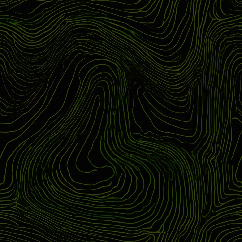
- Color by RGB, elevation, intensity or classification. Eye-dome lighting included
- Works on phones and tablets. Field crews do not carry workstations
← live viewer. pick the ruler and tap two points.
0
points streaming in the demo above
Scale
Built for the files you actually produce
No per-file cap. A terrestrial scan in the tens of gigabytes converts the same way a quick drone flight does. The viewer streams an octree, so the browser loads what the camera sees and nothing else, with the point budget tuned to the device in someone's hand.
Your original data stays intact. The optimized copy is itself a valid LAZ your client can download, if you let them.
Sharing
Share on your terms
One link per file. Add a password when the data is sensitive. Revoke the link the moment a project closes. And see whether the client actually opened it, which is sometimes the most useful number on this page.
Links do not expire on a schedule. A deliverable you sent in March still works in November, because that is how deliverables are supposed to behave.
Share with clients
Who it's for
Three people touch every point cloud
Survey crews
Terrestrial scans, topos, as-builts. Send review links instead of burning USB sticks or wrestling FTP.
Drone operators
Photogrammetry and lidar deliverables your clients can open the day you land, not after they install something.
The people they send links to
Your client needs nothing. No account, no install, no seat. That is the point.
Pricing
You pay for storage, not for tools
Every plan gets every feature. No per-seat math. Send the link to one reviewer or forty.
Starter
$29/mo
50.0 GB · 10 files
Pro
$79/mo
250 GB · 40 files
Business
$199/mo
1.0 TB · 200 files
Straight answers
The questions surveyors ask first
How big can my files be?
There is no per-file cap. Plans limit total storage, not individual files. A 40 GB terrestrial scan is fine.
What formats do you take?
LAS and LAZ, any version. Classification, RGB and intensity come through if your file has them.
What does my client need?
A browser. No account, no install, no plugin, no seat license. The link opens the viewer directly.
Who can see my data?
Only people you give a link to. Links are unguessable tokens, can carry a password, and you can revoke them at any moment.
Can I get my data back out?
Yes. The optimized file is a valid LAZ you can download anytime. Delete a file and it is gone from storage.

The next deliverable you send can be a link.
Plans start at $29 a month and the people you share with never pay anything. Cancel anytime, your data leaves with you.